Innovative Drone Technology for your Project!
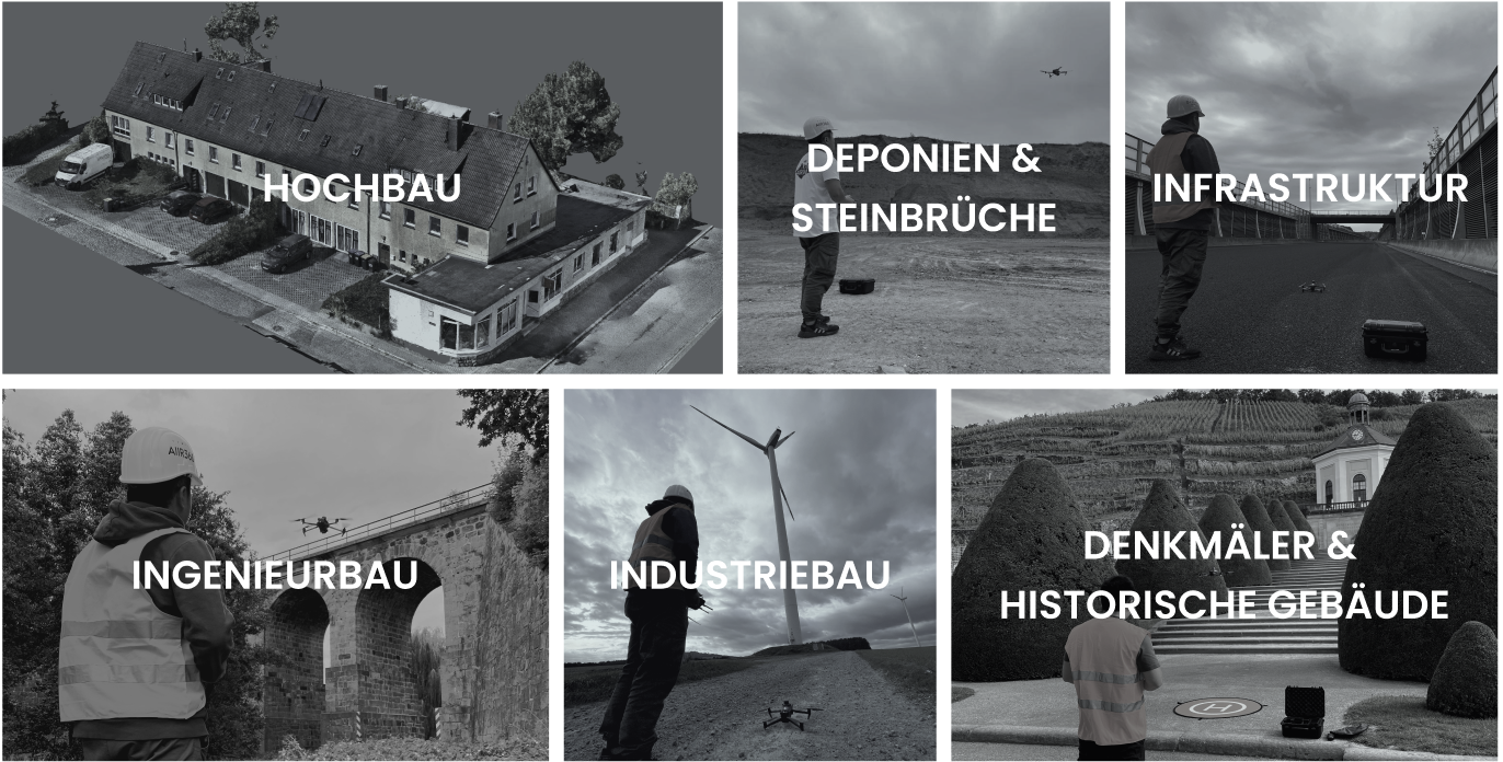
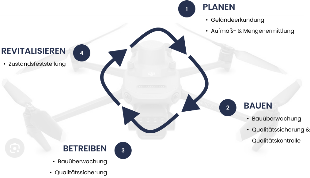
Our drone services support architects, engineers, construction companies, craftsmen, as well as operators and owners of construction projects and real estate throughout all phases of the construction project lifecycle. From consulting and training to aerial surveys and the creation and analysis of digital models, we provide everything you need—all in one place.
One-Stop. One-Shop.
Your Benefits throughout the entire Project Lifecycle
The key advantage of drone surveys in the construction industry lies in their ability to quickly and efficiently capture highly precise and detailed data. Using drones allows construction projects to be analyzed from multiple perspectives, enabling a more comprehensive evaluation.
This technology facilitates tasks such as inspections, site surveys, volume and quantity calculations, and seamless integration of data into digital models. As a result, it enhances the planning, execution, and monitoring of construction projects while improving quality assurance.
Our Services at a Glance
Tell Us Your Requirements, and We’ll Create a Tailored Service Package for You.
AIIR360 Consulting
With Our Expertise, We Help You Customize Our Services to Your Specific Needs and Select the Optimal Technologies for Your Requirements.
AIIR360 Flight
Our Drone Pilots Capture Terrain, Construction Projects, or Industrial Facilities Quickly and Cost-Effectively—No Need for Complex Scaffolding.
AIIR360 Twin
Using Drone Footage, We Create Digital 3D Models That Optimally Support Analyses, Planning, and Simulations for Your Construction Projects, Inspections, or Surveys.
AIIR360 Quantity
Based on 3D Models, We Provide Precise Measurements, Accurate Quantity Calculations, and Reliable Data. This Enables You to Make Informed Decisions for Your Construction and Infrastructure Projects.
AIIR360 Quality
Our Drone-Based Quality Assurance Ensures Precise Construction Monitoring, Early Error Detection, and Efficient Problem-Solving—Fast, Safe, and Cost-Effective.
AIIR360 Survey
Our Expert Team in Engineering, Artificial Intelligence, and Geodesy Delivers Accurate Analyses and Well-Founded Recommendations—Maximizing Value for Your Project.
One Shop one Stop
Our Comprehensive Packages Offer a Complete Solution for Your Projects – All in One Place. From the initial consultation and targeted training to precise drone flights and the creation of high-quality models, all the way to professional analysis, we guide you through every step. With our full-service approach, you save time, reduce coordination efforts, and enjoy a smooth workflow.
Individual Services
In addition to our comprehensive package, we offer the flexibility to book individual services or combine them according to your needs. You select the components that best suit your project. Together, we will develop a tailored service package that perfectly meets your requirements.
Moving forward using new Technologies
– here’s how it works for your project!
Not sure how to efficiently leverage new technologies like drone flights and digital twin modeling for your construction project? Check out our blog for insights!
Our Drone
The DJI Mavic 3E is perfectly suited for surveying applications, delivering precise and distortion-free data thanks to its 20MP sensor with a mechanical shutter. With a flight time of over 40 minutes and the ability to cover up to 2 km² per battery, it’s ideal for large areas. The RTK module ensures positional accuracy within a few centimeters, while its compact, foldable design makes transportation easy. Features like waypoint planning and a stabilized 4/3” sensor also make it exceptionally efficient and versatile.


